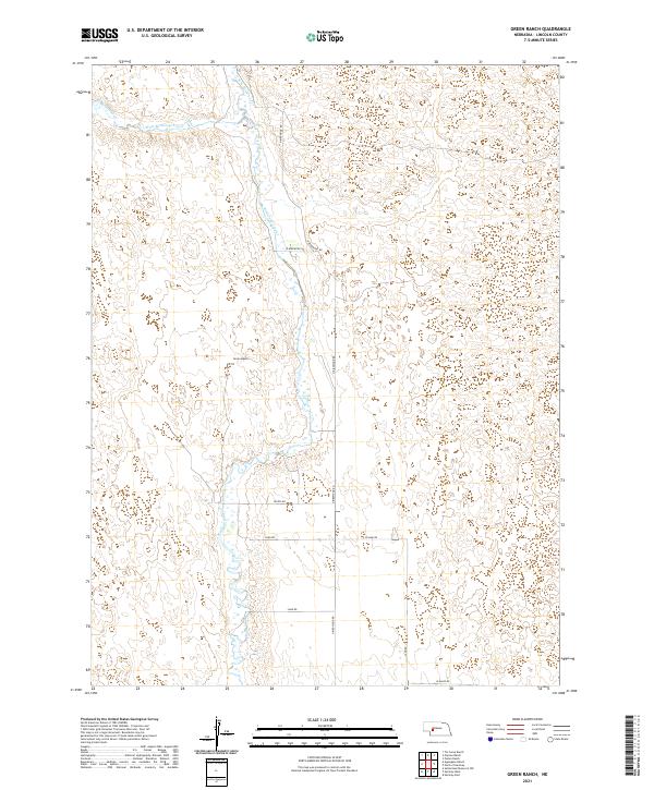
2021 Map of Green Ranch
USGS Topo · Published 2021About this map
Birdwood Creek and its various tributaries, including West Birdwood Creek and the N Fork Birdwood Cr, dominate this sparsely populated portion of Lincoln County. The drainage network illustrates the hydrologic patterns of the Nebraska Sandhills, where the namesake Green Ranch stands as a primary point of human settlement. The landscape is structured by a grid of rural routes such as N Birdwood Rd and Land Rd, which provide access to the vast ranching tracts that define the region's economy. The interplay of these section-line roads and the winding paths of W Birdwood Cr reveals the adaptation of pastoral land use to the natural contours of the northern Nebraska terrain.
Find a feature on this map
16 named features on this map. Tap any name to fly to it.
Don’t see what you’re looking for? This feature index may not catch every label — zoom into the map to look around manually.
Map Details
Editions of this 2021 Green Ranch Map
This is the sole edition of this map. No revisions or reprints were ever made.
Other maps of this area

1898 · Paxton
USGS Topo · 1:125,000

1899 · North Platte
USGS Topo · 1:125,000

1901 · Paxton
USGS Topo · 1:125,000

1902 · North Platte
USGS Topo · 1:125,000

1954 · North Platte
USGS Topo · 1:250,000

1956 · North Platte
USGS Topo · 1:250,000

1957 · North Platte
USGS Topo · 1:250,000

1967 · North Platte
USGS Topo · 1:250,000
1970 · Hershey East
USGS Topo · 1:24,000
1971 · Hershey West
USGS Topo · 1:24,000