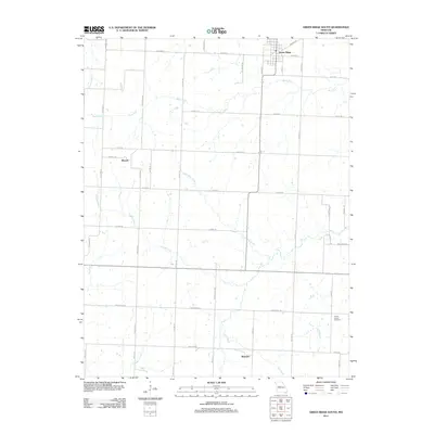
2011 Map of Green Ridge South
USGS Topo · Published 2011About this map
Green Ridge serves as the northern anchor of this landscape, situated at the intersection of Highway B and Wisdom Rd. The terrain is defined by a dense network of meandering waterways, including Basin Fork, North Flat Creek, and Elm Branch, which carve through the rural countryside. Small unincorporated communities like Bryson and Brandon are connected by a grid of family-named roads such as Swisher Rd, Ruffin Rd, and Meyers Rd, reflecting a longstanding agricultural layout. The presence of the Prairie Chapel Cemetery near the junction of Funk Ln and Elm Branch Rd provides a specific point of interest for genealogists tracing local families. This survey demonstrates the persistence of rural settlement patterns and the complex drainage system of the Missouri prairie in the early 21st century.
Find a feature on this map
45 named features on this map. Tap any name to fly to it.
Don’t see what you’re looking for? This feature index may not catch every label — zoom into the map to look around manually.
Map Details
Editions of this 2011 Green Ridge South Map
This is the sole edition of this map. No revisions or reprints were ever made.
Other maps of this area

1885 · Warrensburg
USGS Topo · 1:125,000

1887 · Clinton
USGS Topo · 1:125,000

1887 · Sedalia
USGS Topo · 1:125,000

1887 · Warsaw
USGS Topo · 1:125,000

1887 · Warrensburg
USGS Topo · 1:125,000

1894 · Warsaw
USGS Topo · 1:125,000

1894 · Sedalia
USGS Topo · 1:125,000

1894 · Warrensburg
USGS Topo · 1:125,000

1894 · Clinton
USGS Topo · 1:125,000

1944 · Sedalia West
USGS Topo · 1:24,000