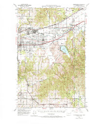
1949 Map of Greenacres
USGS Topo · Published 1970About this map
Industrial expansion and military logistics dominate the post-war landscape along the Spokane River valley. The massive Naval Supply Depot at Velox and the nearby Aluminum Rolling Mill represent a period of significant economic development between Trentwood and Irvin. This corridor is dense with transportation infrastructure, where the Northern Pacific, Spokane International, and Great Northern railroads converge to serve the valley's growing industrial output and the residential clusters of Opportunity and Greenacres.
Find a feature on this map
86 named features on this map. Tap any name to fly to it.
Don’t see what you’re looking for? This feature index may not catch every label — zoom into the map to look around manually.
Map Details
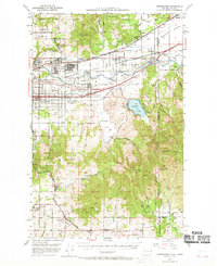
Editions of this 1949 Greenacres Map
3 editions found
Other maps of this area

1901 · Spokane
USGS Topo · 1:125,000

1903 · Oakesdale
USGS Topo · 1:125,000

1903 · Rathdrum
USGS Topo · 1:125,000

1905 · Oakesdale
USGS Topo · 1:125,000

1943 · Mt Spokane
USGS Topo · 1:62,500

1949 · Deer Park
USGS Topo · 1:62,500

1949 · Greenacres
USGS Topo · 1:62,500

1950 · Spokane NE
USGS Topo · 1:24,000

1950 · Spokane SE
USGS Topo · 1:24,000

1950 · Mt Spokane
USGS Topo · 1:62,500