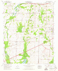
1963 Map of Greenbrier
USGS Topo · Published 1965About this map
Madison and the smaller settlements of Greenbrier and Belle Mina anchor this early 1960s survey of the Limestone and Madison County line. The Southern Railway corridor serves as the primary industrial artery, passing through the heart of these cotton-growing communities. Agriculture remains a dominant force on the landscape, evidenced by local landmarks like the Burgreen Gin and the extensive network of rural churches and schools, such as Parker Chapel and Greenbrier School.
Find a feature on this map
50 named features on this map. Tap any name to fly to it.
Don’t see what you’re looking for? This feature index may not catch every label — zoom into the map to look around manually.
Map Details
Editions of this 1963 Greenbrier Map
This is the sole edition of this map. No revisions or reprints were ever made.
Other maps of this area

1888 · Huntsville
USGS Topo · 1:125,000

1892 · Huntsville
USGS Topo · 1:125,000

1935 · Athens
USGS Topo · 1:24,000

1936 · Jeff
USGS Topo · 1:24,000

1936 · Capshaw
USGS Topo · 1:24,000

1936 · Triana
USGS Topo · 1:24,000

1936 · Madison
USGS Topo · 1:24,000

1936 · Decatur
USGS Topo · 1:24,000

1936 · Mason Ridge
USGS Topo · 1:24,000

1936 · Tanner
USGS Topo · 1:24,000