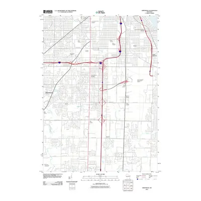
2010 Map of Greendale
USGS Topo · Published 2010About this map
Mount Olivet Cemetery, Saint Adalberts Cemetery, and Arlington Cemetery anchor a dense network of memorial grounds that define the landscape south of Milwaukee. This 2010 survey illustrates the suburban character of Greendale and Saint Francis, where residential grids are partitioned by major thoroughfares like W Cleveland Ave and W Layton Ave. The eastern portion is dominated by the sprawling infrastructure of General Mitchell International Airport, while the western side is shaped by the winding course of the Root River.
Find a feature on this map
41 named features on this map. Tap any name to fly to it.
Don’t see what you’re looking for? This feature index may not catch every label — zoom into the map to look around manually.
Map Details
Editions of this 2010 Greendale Map
This is the sole edition of this map. No revisions or reprints were ever made.
Other maps of this area

1891 · Bayview
USGS Topo · 1:62,500

1891 · Muskego
USGS Topo · 1:62,500

1892 · Milwaukee
USGS Topo · 1:62,500

1892 · Waukesha
USGS Topo · 1:62,500

1901 · Milwaukee
USGS Topo · 1:62,500

1901 · Waukesha
USGS Topo · 1:62,500

1901 · Bayview
USGS Topo · 1:62,500

1901 · Muskego
USGS Topo · 1:62,500

1906 · Waukesha
USGS Topo · 1:62,500

1906 · Milwaukee
USGS Topo · 1:62,500