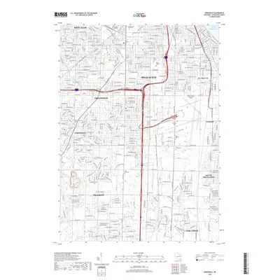
2018 Map of Greendale
USGS Topo · Published 2018About this map
Lake Michigan forms the eastern boundary of this developed suburban and industrial landscape south of Milwaukee. The terrain is defined by a dense network of residential streets and arterial roads that weave between several major municipal boundaries, including Greenfield, Cudahy, and Franklin. The area's commemorative and religious history is prominently marked by a high concentration of large cemeteries such as Forest Home Cem Soldiers Lot, Mount Olivet Cem, and Saint Adalberts Cem. Hydrological features like the Kinnickinnic River and the Root River provide natural drainage through these established neighborhoods, while smaller bodies of water like Scout Lake and Mud Lake offer localized ecological breaks in the urban grid. This 2018 survey captures the intricate infrastructure of south Milwaukee County, showing the mature development patterns from West Allis down to Oak Creek.
Find a feature on this map
150 named features on this map. Tap any name to fly to it.
Don’t see what you’re looking for? This feature index may not catch every label — zoom into the map to look around manually.
Map Details
Editions of this 2018 Greendale Map
This is the sole edition of this map. No revisions or reprints were ever made.
Other maps of this area

1891 · Bayview
USGS Topo · 1:62,500

1891 · Muskego
USGS Topo · 1:62,500

1892 · Milwaukee
USGS Topo · 1:62,500

1892 · Waukesha
USGS Topo · 1:62,500

1901 · Milwaukee
USGS Topo · 1:62,500

1901 · Waukesha
USGS Topo · 1:62,500

1901 · Bayview
USGS Topo · 1:62,500

1901 · Muskego
USGS Topo · 1:62,500

1906 · Waukesha
USGS Topo · 1:62,500

1906 · Milwaukee
USGS Topo · 1:62,500