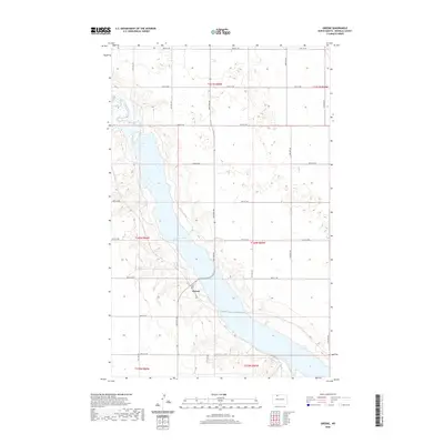
2020 Map of Greene
USGS Topo · Published 2020About this map
Lake Darling dominates the central corridor of this North Dakota landscape, a significant reservoir formed by the damming of the Souris River. The small community of Greene sits along the southwestern shore of the lake, serving as a primary point of reference in this rural expanse. The map illustrates the characteristic section-line road grid of Renville County, with thoroughfares such as 92nd St NW and 84th St NW marking the northern and southern limits of the study area.
Find a feature on this map
18 named features on this map. Tap any name to fly to it.
Don’t see what you’re looking for? This feature index may not catch every label — zoom into the map to look around manually.
Map Details
Editions of this 2020 Greene Map
This is the sole edition of this map. No revisions or reprints were ever made.
Other maps of this area

1947 · Tolley
USGS Topo · 1:62,500

1948 · Mohall
USGS Topo · 1:24,000

1948 · Tolley
USGS Topo · 1:24,000

1949 · Tolley SE
USGS Topo · 1:24,000

1949 · Mohall SW
USGS Topo · 1:24,000

1949 · Grano SW
USGS Topo · 1:24,000

1949 · Greene
USGS Topo · 1:24,000

1949 · Grano
USGS Topo · 1:24,000

1949 · Grano NE
USGS Topo · 1:24,000

1949 · Mouse River Park
USGS Topo · 1:24,000