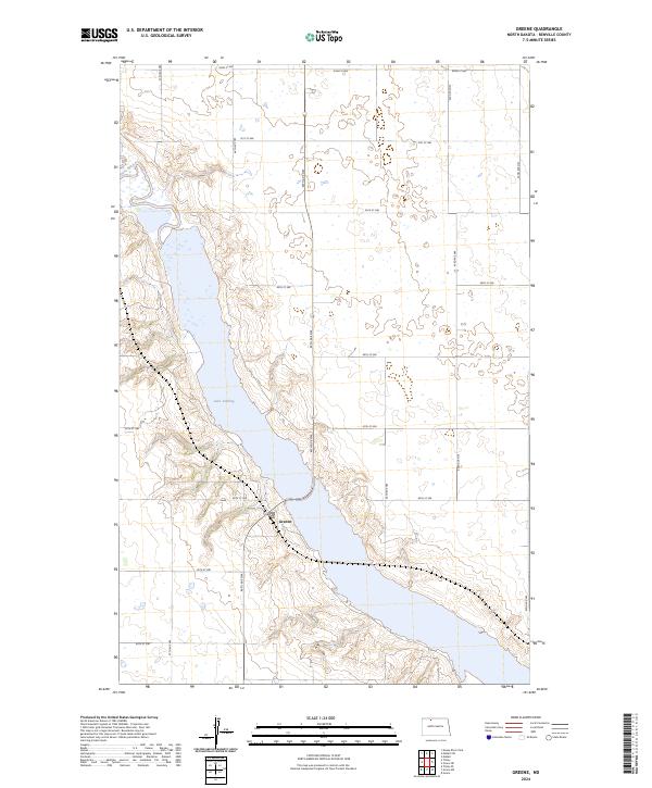
2024 Map of Greene
USGS Topo · Published 2024About this map
Lake Darling and the valley of the Souris River dominate this Renville County landscape, where the water's path is preserved by the Upper Souris National Wildlife Refuge. The settlement of Greene sits just west of the river valley, surrounded by a grid of agricultural roads that define the North Dakota prairie. The topography reveals the intricate draw and coulee systems that feed into the central reservoir, contrasted by the level plains above the valley floor. Conservation efforts are evident across the quadrangle, notably within the Renville County Waterfowl Production Area. This recent survey illustrates the modern configuration of the refuge boundaries and the persistence of the rural road network, which remains anchored by routes like 46th Ave NW and 87th St NW.
Find a feature on this map
26 named features on this map. Tap any name to fly to it.
Don’t see what you’re looking for? This feature index may not catch every label — zoom into the map to look around manually.
Map Details
Editions of this 2024 Greene Map
This is the sole edition of this map. No revisions or reprints were ever made.
Other maps of this area

1947 · Tolley
USGS Topo · 1:62,500

1948 · Mohall
USGS Topo · 1:24,000

1948 · Tolley
USGS Topo · 1:24,000

1949 · Tolley SE
USGS Topo · 1:24,000

1949 · Mohall SW
USGS Topo · 1:24,000

1949 · Grano SW
USGS Topo · 1:24,000

1949 · Greene
USGS Topo · 1:24,000

1949 · Grano
USGS Topo · 1:24,000

1949 · Grano NE
USGS Topo · 1:24,000

1949 · Mouse River Park
USGS Topo · 1:24,000