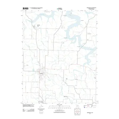
2011 Map of Greenfield
USGS Topo · Published 2011About this map
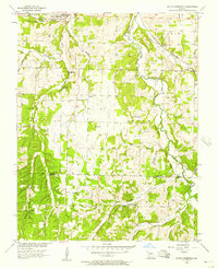
The town of Greenfield serves as the focal point of this 2011 survey, situated just north of South Greenfield in Missouri's Dade County. The landscape is defined by the branching arms of Stockton Lake, which dominate the northern portion of the quadrangle. This reservoir landscape creates a series of prominent landforms along its shores, including Shaw Bluff and Sand Mountain. The map illustrates a transition from the structured residential grid of the town to the rural drainage basins of Turnback Creek and Limestone Creek. Notable family and local landmarks are preserved in the labels of several burial grounds, such as Fanning Cemetery, Young Cemetery, and Wetzel Cemetery. Further south, the historical crossing at Fiddlers Ford marks a point of interest on the creek, while the Eagles Point and Red Barn Village Airpark reflects the more modern developments in the area's transportation infrastructure.
Find a feature on this map
72 named features on this map. Tap any name to fly to it.
Don’t see what you’re looking for? This feature index may not catch every label — zoom into the map to look around manually.
Map Details
Editions of this 2011 Greenfield Map
This is the sole edition of this map. No revisions or reprints were ever made.
Other maps of this area

1886 · Stockton
USGS Topo · 1:125,000

1886 · Greenfield
USGS Topo · 1:125,000

1888 · Greenfield
USGS Topo · 1:125,000

1954 · Springfield
USGS Topo · 1:250,000

1955 · Dadeville
USGS Topo · 1:24,000
1956 · Kings Point
USGS Topo · 1:24,000

1956 · Greenfield
USGS Topo · 1:24,000
1956 · Lockwood
USGS Topo · 1:24,000
1956 · Bona
USGS Topo · 1:24,000
1956 · South Greenfield
USGS Topo · 1:24,000