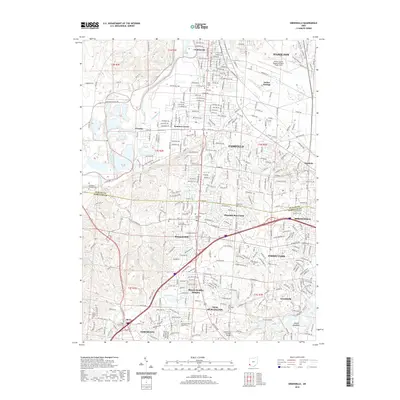
2019 Map of Greenhills
USGS Topo · Published 2019About this map
Fairfield and its surrounding suburban landscape define this corridor between the Great Miami River and the industrial hubs of Springdale and Forest Park. The transition from the alluvial plain of the river up to the heights of Lick Ridge illustrates the expansion of metropolitan Cincinnati's northern reach. This survey details the established residential patterns in Greenhills and Lindenwald, punctuated by a high density of small family and community burial grounds such as Huston Cem and the New Burlington Cem.
Find a feature on this map
72 named features on this map. Tap any name to fly to it.
Don’t see what you’re looking for? This feature index may not catch every label — zoom into the map to look around manually.
Map Details
Editions of this 2019 Greenhills Map
This is the sole edition of this map. No revisions or reprints were ever made.
Other maps of this area

1898 · East Cincinnati
USGS Topo · 1:62,500

1904 · Mason
USGS Topo · 1:62,500

1906 · Mason
USGS Topo · 1:62,500

1914 · East Cincinnati
USGS Topo · 1:62,500

1914 · West Cincinnati
USGS Topo · 1:62,500

1915 · Hamilton
USGS Topo · 1:62,500

1917 · Hamilton
USGS Topo · 1:62,500
1953 · Cincinnati East
USGS Topo · 1:24,000

1953 · Cincinnati West
USGS Topo · 1:24,000

1953 · Cincinnati
USGS Topo · 1:250,000