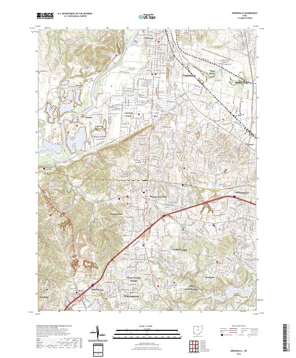
2023 Map of Greenhills
USGS Topo · Published 2023About this map
The Great Miami River carves through the northwestern portion of this terrain, marking a distinct boundary near the growing suburbs of Fairfield and Hamilton. This landscape is defined by its transition from industrial and residential centers like Lindenwald and Symmes Corner into the expansive planned communities of the mid-20th century. Local history and genealogy are well-preserved in the numerous burial grounds distributed across the townships, including the Fairfield Trustees Cem and the Saint Mary Cem.
Find a feature on this map
46 named features on this map. Tap any name to fly to it.
Don’t see what you’re looking for? This feature index may not catch every label — zoom into the map to look around manually.
Map Details
Editions of this 2023 Greenhills Map
This is the sole edition of this map. No revisions or reprints were ever made.
Other maps of this area

1898 · East Cincinnati
USGS Topo · 1:62,500

1904 · Mason
USGS Topo · 1:62,500

1906 · Mason
USGS Topo · 1:62,500

1914 · East Cincinnati
USGS Topo · 1:62,500

1914 · West Cincinnati
USGS Topo · 1:62,500

1915 · Hamilton
USGS Topo · 1:62,500

1917 · Hamilton
USGS Topo · 1:62,500
1953 · Cincinnati East
USGS Topo · 1:24,000

1953 · Cincinnati West
USGS Topo · 1:24,000

1953 · Cincinnati
USGS Topo · 1:250,000