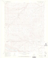
1967 Map of Greenie Mountain
USGS Topo · Published 1970About this map
Greenie Mountain rises above a landscape defined by high-elevation parks and the drainage basins of the Alamosa River and South Fork Creek. During the late 1960s, this area of the Rio Grande National Forest supported seasonal mountain activities, evident in the presence of Phillips University Camp, Camp Val Verde, and several Forest Service sites like Alamosa Campground and Comstock Campground.
Find a feature on this map
47 named features on this map. Tap any name to fly to it.
Don’t see what you’re looking for? This feature index may not catch every label — zoom into the map to look around manually.
Map Details
Editions of this 1967 Greenie Mountain Map
4 editions found
Other maps of this area

1915 · Del Norte
USGS Topo · 1:125,000

1917 · Del Norte
USGS Topo · 1:125,000

1922 · Conejos
USGS Topo · 1:125,000

1945 · Durango
USGS Topo · 1:250,000

1953 · Durango
USGS Topo · 1:250,000

1954 · Durango
USGS Topo · 1:250,000

1961 · Durango
USGS Topo · 1:250,000

1963 · Durango
USGS Topo · 1:250,000

1964 · Monte Vista
USGS Topo · 1:24,000

1966 · Durango
USGS Topo · 1:250,000