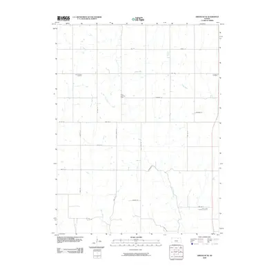
2009 Map of Greenleaf SE
USGS Topo · Published 2009About this map
Spring Valley Cemetery and Cottage Hill Cemetery anchor the northern landscape of Riley County in this 2009 survey, reflecting the long-standing rural settlement patterns of the region. The terrain is defined by a dendritic network of waterways, including Sulphur Creek and Swede Creek, which flow through a grid of section roads. The naming of School Branch and local thoroughfares like Peach Grove Rd and Droll Rd suggest the localized historical geography of early school districts and family homesteads. To the south, Fancy Creek Randolph Cemetery stands near the intersection of modern transit and older rural routes. A notable private aviation landmark, the Potts Landing Strip, is situated centrally among the agricultural plots, illustrating the intersection of traditional farming and modern utility in this Kansas interior.
Find a feature on this map
29 named features on this map. Tap any name to fly to it.
Don’t see what you’re looking for? This feature index may not catch every label — zoom into the map to look around manually.
Map Details
Editions of this 2009 Greenleaf SE Map
This is the sole edition of this map. No revisions or reprints were ever made.
Other maps of this area

1886 · Junction City
USGS Topo · 1:125,000

1889 · Marysville
USGS Topo · 1:125,000

1889 · Junction City
USGS Topo · 1:125,000

1894 · Junction City
USGS Topo · 1:125,000

1894 · Marysville
USGS Topo · 1:125,000

1955 · Manhattan
USGS Topo · 1:250,000

1956 · Manhattan
USGS Topo · 1:250,000

1957 · Manhattan
USGS Topo · 1:250,000
1963 · Lasita
USGS Topo · 1:24,000
1964 · Randolph
USGS Topo · 1:24,000