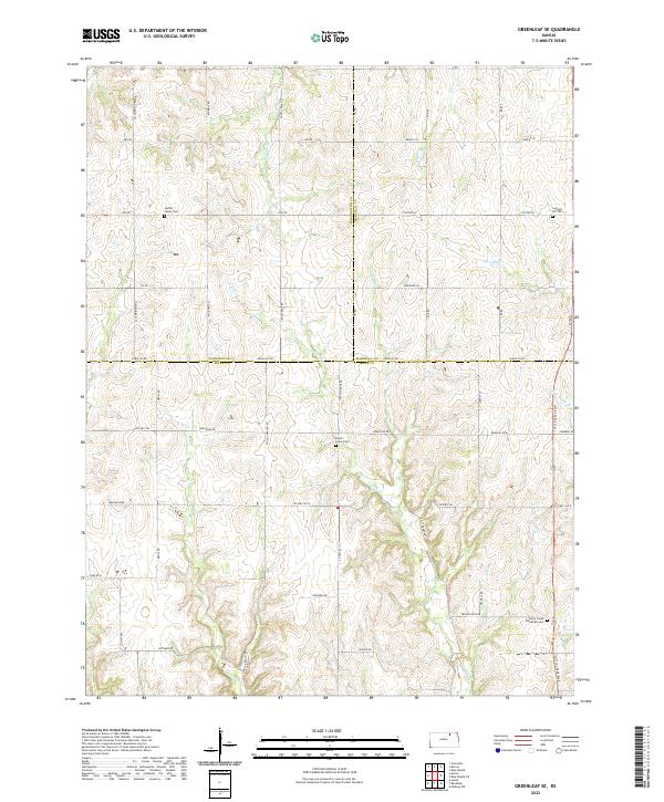
2022 Map of Greenleaf SE
USGS Topo · Published 2022About this map
The rolling section lines of north-central Kansas converge where Riley, Washington, and Marshall Counties meet in this detailed landscape. A series of community burial grounds, including Spring Valley Cem, Cottage Hill Cem, and Peach Grove Cem, highlight the enduring rural settlement patterns of the region. The terrain is defined by a network of drainage branches, notably Sulphur Cr and N Otter Cr, which cut through the agricultural sections and dictate the path of local corridors like Peach Grove Rd and Tuttle Creek Blvd. Further south, the Fancy Creek Randolph Cem sits near the headwaters of School Br, indicating a historic cluster of activity at the southern edge of this upland prairie environment. The map provides a clear picture of the modern road grid laid over traditional township boundaries, such as t5s r5e and t6s r6e.
Find a feature on this map
47 named features on this map. Tap any name to fly to it.
Don’t see what you’re looking for? This feature index may not catch every label — zoom into the map to look around manually.
Map Details
Editions of this 2022 Greenleaf SE Map
This is the sole edition of this map. No revisions or reprints were ever made.
Other maps of this area

1886 · Junction City
USGS Topo · 1:125,000

1889 · Marysville
USGS Topo · 1:125,000

1889 · Junction City
USGS Topo · 1:125,000

1894 · Junction City
USGS Topo · 1:125,000

1894 · Marysville
USGS Topo · 1:125,000

1955 · Manhattan
USGS Topo · 1:250,000

1956 · Manhattan
USGS Topo · 1:250,000

1957 · Manhattan
USGS Topo · 1:250,000
1963 · Lasita
USGS Topo · 1:24,000
1964 · Randolph
USGS Topo · 1:24,000