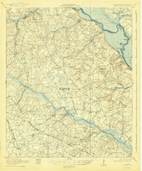
1920 Map of Greens Cut
USGS Topo · Published 1943About this map
Brier Creek and its southern tributaries, Sand Branch and Fitz Branch, carve through the agrarian landscape of Burke County just after World War I. This era is defined by a dense network of localized community centers, often anchored by rural education and faith as seen at Fairfield School and Daniel Grove Church. The settlement at Shell Bluff sits near the winding Savannah River, where Shell Bluff Landing and Hancock Landing indicate the continuing importance of river access even as the Georgia and Augusta Road facilitated overland travel.
Find a feature on this map
52 named features on this map. Tap any name to fly to it.
Don’t see what you’re looking for? This feature index may not catch every label — zoom into the map to look around manually.
Map Details
Editions of this 1920 Greens Cut Map
3 editions found
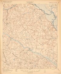
Other maps of this area

1919 · Gough
USGS Topo · 1:62,500

1920 · Ellenton
USGS Topo · 1:48,000

1920 · Hilltonia
USGS Topo · 1:62,500

1920 · Millen
USGS Topo · 1:62,500

1920 · Greens Cut
USGS Topo · 1:62,500

1920 · Talatha
USGS Topo · 1:48,000

1921 · Augusta
USGS Topo · 1:62,500

1921 · Talatha
USGS Topo · 1:62,500

1921 · Ellenton
USGS Topo · 1:62,500

1922 · Hephzibah
USGS Topo · 1:62,500