
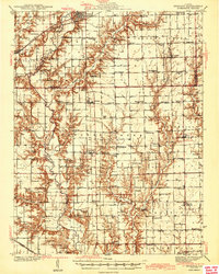
1943 Map of Greenup
USGS Topo · Published 1943About this map
Embarrass River meanders through the heart of this landscape, its winding course defining the border between Cumberland and Jasper counties. The village of Greenup serves as a primary hub, situated at the intersection of the historic National Road and the Pennsylvania and Illinois Central railroads. This mid-century survey captures a densely settled agricultural region defined by an extensive network of small rural institutions, including dozens of local schools such as Walla Walla Sch, Scotch Chapel Sch, and Little Brown Sch. The social fabric of the era is further evidenced by several country churches, from the Universalist Ch to Bethany Ch. Moving south, the map details smaller settlements like Yale, Hidalgo, and Hunt City, connected by a grid of farm roads and the Central Illinois rail line.
Find a feature on this map
93 named features on this map. Tap any name to fly to it.
Don’t see what you’re looking for? This feature index may not catch every label — zoom into the map to look around manually.
Map Details
Editions of this 1943 Greenup Map
2 editions found
Other maps of this area

1910 · Hardinville
USGS Topo · 1:62,500

1933 · Toledo
USGS Topo · 1:62,500

1934 · Mattoon
USGS Topo · 1:62,500

1936 · Casey
USGS Topo · 1:48,000

1937 · Mattoon
USGS Topo · 1:62,500

1938 · Toledo
USGS Topo · 1:62,500

1940 · Greenup
USGS Topo · 1:62,500

1941 · Newton
USGS Topo · 1:62,500

1942 · Casey
USGS Topo · 1:62,500

1943 · Casey
USGS Topo · 1:62,500