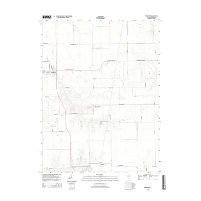
2015 Map of Greenview
USGS Topo · Published 2015About this map
Greenview and the surrounding agricultural lands of Menard County are defined by a grid of rural roads and the winding paths of several creeks. The village of Greenview itself is organized around a traditional street plan featuring W Adams St, W Van Buren St, and E Douglas St. To the west of the residential core lies Elmwood Cem, while the smaller settlement of Sweetwater serves as a secondary focal point to the southeast. The landscape is deeply etched by watercourses such as Grove Cr, which meanders past the Sugar Grove Cem, and Indian Cr further south near Culver. These drainages create subtle variations in the terrain, breaking the otherwise regular pattern of farm-to-market roads like Middletown Blacktop Ave and Sweetwater Ave that facilitate the region's agricultural economy.
Find a feature on this map
55 named features on this map. Tap any name to fly to it.
Don’t see what you’re looking for? This feature index may not catch every label — zoom into the map to look around manually.
Map Details
Editions of this 2015 Greenview Map
This is the sole edition of this map. No revisions or reprints were ever made.
Other maps of this area

1907 · Springfield
USGS Topo · 1:62,500

1909 · Tallula
USGS Topo · 1:62,500

1930 · Springfield
USGS Topo · 1:62,500

1933 · Petersburg
USGS Topo · 1:62,500

1938 · Petersburg
USGS Topo · 1:62,500

1940 · Tallula
USGS Topo · 1:62,500

1940 · Springfield
USGS Topo · 1:62,500

1948 · Mason City
USGS Topo · 1:62,500

1949 · Mason City
USGS Topo · 1:62,500

1958 · Peoria
USGS Topo · 1:250,000