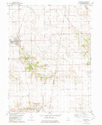
1980 Map of Greenview
USGS Topo · Published 1980About this map
Greenview serves as the primary population center on this central Illinois prairie landscape, where the street grid is intersected by the Gulf Mobile and Ohio railroad. To the south and east, the terrain becomes more varied as it descends toward Pike Creek and Grove Creek, which cut through the agricultural land. Smaller settlements like Sweet Water and Culver dot the countryside, reflecting the rural development patterns of the late 20th century.
Find a feature on this map
19 named features on this map. Tap any name to fly to it.
Don’t see what you’re looking for? This feature index may not catch every label — zoom into the map to look around manually.
Map Details
Editions of this 1980 Greenview Map
This is the sole edition of this map. No revisions or reprints were ever made.
Other maps of this area

1907 · Springfield
USGS Topo · 1:62,500

1909 · Tallula
USGS Topo · 1:62,500

1930 · Springfield
USGS Topo · 1:62,500

1933 · Petersburg
USGS Topo · 1:62,500

1938 · Petersburg
USGS Topo · 1:62,500

1940 · Tallula
USGS Topo · 1:62,500

1940 · Springfield
USGS Topo · 1:62,500

1948 · Mason City
USGS Topo · 1:62,500

1949 · Mason City
USGS Topo · 1:62,500

1958 · Peoria
USGS Topo · 1:250,000