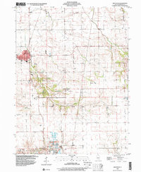
1998 Map of Greenview
USGS Topo · Published 2000About this map
The agrarian landscape of Menard County is meticulously documented in this late 1990s survey, defined by the winding paths of Grove Creek and Sugar Grove Creek. The village of Greenview serves as the primary hub, while smaller named locales such as Sweet Water and Culver suggest the historical settlement patterns of this central Illinois region. In the south, the terrain becomes more distinct at Indian Point, where a large industrial Quarry operation is prominent.
Find a feature on this map
15 named features on this map. Tap any name to fly to it.
Don’t see what you’re looking for? This feature index may not catch every label — zoom into the map to look around manually.
Map Details
Editions of this 1998 Greenview Map
This is the sole edition of this map. No revisions or reprints were ever made.
Other maps of this area

1907 · Springfield
USGS Topo · 1:62,500

1909 · Tallula
USGS Topo · 1:62,500

1930 · Springfield
USGS Topo · 1:62,500

1933 · Petersburg
USGS Topo · 1:62,500

1938 · Petersburg
USGS Topo · 1:62,500

1940 · Tallula
USGS Topo · 1:62,500

1940 · Springfield
USGS Topo · 1:62,500

1948 · Mason City
USGS Topo · 1:62,500

1949 · Mason City
USGS Topo · 1:62,500

1958 · Peoria
USGS Topo · 1:250,000