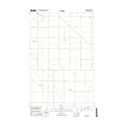
2016 Map of Greenview
USGS Topo · Published 2016About this map
The agricultural landscape of Polk County is defined here by an extensive network of water management, illustrated by numerous engineered channels like County Ditch Number One Hundred Fortythree and County Ditch Number One Hundred Fortyfour. These numbered ditches form a rigid grid that facilitates the drainage of the Red River Valley, intersecting with the natural meanders of Burnham Cr. The map captures the small settlements of Burwell in the northeast and Greenview to the south, which serve as quiet hubs for the surrounding farmsteads. A high-density grid of gravel and paved roads, including Co RD 214 and Co HWY 45, connects these rural outposts. The survey reflects the meticulous organization of the Public Land Survey System, with section lines and township boundaries such as t149n r46w clearly demarcating the productive prairie land.
Find a feature on this map
31 named features on this map. Tap any name to fly to it.
Don’t see what you’re looking for? This feature index may not catch every label — zoom into the map to look around manually.
Map Details
Editions of this 2016 Greenview Map
This is the sole edition of this map. No revisions or reprints were ever made.
Other maps of this area
1918 · Red Lake Falls
USGS Topo · 1:62,500
1919 · Beltrami
USGS Topo · 1:62,500
1952 · Red Lake Falls
USGS Topo · 1:62,500
1952 · Grand Forks
USGS Topo · 1:250,000
1953 · Crookston
USGS Topo · 1:62,500
1956 · Grand Forks
USGS Topo · 1:250,000
1964 · Beltrami
USGS Topo · 1:24,000
1964 · Beltrami SW
USGS Topo · 1:24,000
1964 · Girard
USGS Topo · 1:24,000
1964 · Greenview
USGS Topo · 1:24,000