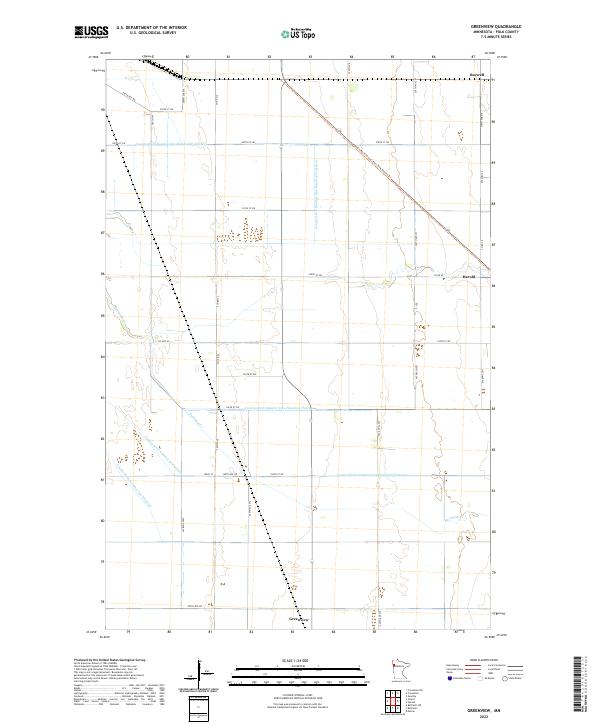
2022 Map of Greenview
USGS Topo · Published 2022About this map
Greenview and the nearby settlements of Burwell and Harold anchor this portion of the Red River Valley in Polk County, where the landscape is defined by a highly organized system of water management. The terrain is crisscrossed by an extensive network of drainage channels, including County Ditch Number One Hundred Fortyfour and County Ditch Number Seventyfour, which redirect water through the agricultural flats toward Burnham Cr. This complex infrastructure reveals the intensive modification of the natural hydrology required to sustain the region's productive farmland. Cutting diagonally across the north is the Agassiz Recreational Trail-Polk County Trl, occupying a former rail corridor that once connected these rural communities. The map provides a precise view of the section lines and township boundaries, such as t149n r46w, that dictate the grid-like placement of roads and farmsteads throughout the township.
Find a feature on this map
39 named features on this map. Tap any name to fly to it.
Don’t see what you’re looking for? This feature index may not catch every label — zoom into the map to look around manually.
Map Details
Editions of this 2022 Greenview Map
This is the sole edition of this map. No revisions or reprints were ever made.
Other maps of this area

1918 · Red Lake Falls
USGS Topo · 1:62,500

1919 · Beltrami
USGS Topo · 1:62,500

1952 · Red Lake Falls
USGS Topo · 1:62,500

1952 · Grand Forks
USGS Topo · 1:250,000

1953 · Crookston
USGS Topo · 1:62,500

1956 · Grand Forks
USGS Topo · 1:250,000

1964 · Beltrami
USGS Topo · 1:24,000

1964 · Beltrami SW
USGS Topo · 1:24,000

1964 · Girard
USGS Topo · 1:24,000

1964 · Greenview
USGS Topo · 1:24,000