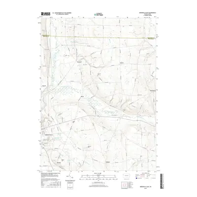
2016 Map of Greenville East
USGS Topo · Published 2016About this map
The Little Shenango River and its numerous tributaries, including Crooked Creek and Saul Run, dominate this section of Mercer County. Water management is a central theme of the landscape, evidenced by the Greenville Reservoir and Saul Run Dam Reservoir, which support the nearby borough of Greenville. A fascinating historical artifact is the Erie Extension Canal trace in the northwest, a remnant of Pennsylvania's nineteenth-century transportation network that once linked the Ohio River to Lake Erie.
Find a feature on this map
120 named features on this map. Tap any name to fly to it.
Don’t see what you’re looking for? This feature index may not catch every label — zoom into the map to look around manually.
Map Details
Editions of this 2016 Greenville East Map
This is the sole edition of this map. No revisions or reprints were ever made.
Other maps of this area

1906 · Linesville
USGS Topo · 1:62,500

1908 · Shenango
USGS Topo · 1:62,500

1908 · Linesville
USGS Topo · 1:62,500

1911 · Stoneboro
USGS Topo · 1:62,500

1913 · Stoneboro
USGS Topo · 1:62,500

1923 · Meadville
USGS Topo · 1:62,500

1925 · Meadville
USGS Topo · 1:62,500

1943 · Meadville
USGS Topo · 1:62,500

1943 · Stoneboro
USGS Topo · 1:62,500

1950 · Cleveland
USGS Topo · 1:250,000
Featured Places
- Salem, Sugar Grove Township
- Perry Township, PA
- Sugar Grove Township, PA
- West Fallowfield Township, PA
- Osgood, Sugar Grove Township