
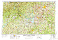
1954 Map of Greenville
USGS Topo · Published 1965About this map
Brasstown Bald and the high peaks of the Blue Ridge dominate the northwestern portion of this mid-century survey, which documents the expanding water infrastructure and urban growth of the Piedmont. The landscape reflects the significant impact of the U.S. Geological Survey and the Army Map Service in mapping this critical region where Georgia, South Carolina, and North Carolina converge. The recent impoundment of the Hartwell Reservoir and Lake Sidney Lanier has fundamentally altered the hydrology of the Savannah and Broad river systems, creating new shorelines that would soon transform local economies.
Find a feature on this map
152 named features on this map. Tap any name to fly to it.
Don’t see what you’re looking for? This feature index may not catch every label — zoom into the map to look around manually.
Map Details
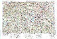
Editions of this 1954 Greenville Map
3 editions found
Other maps of this area

1886 · Dahlonega
USGS Topo · 1:125,000

1886 · Walhalla
USGS Topo · 1:125,000

1888 · Ellijay
USGS Topo · 1:125,000

1888 · Pickens
USGS Topo · 1:125,000

1888 · Atlanta
USGS Topo · 1:125,000

1890 · Suwanee
USGS Topo · 1:125,000

1890 · Atlanta
USGS Topo · 1:125,000

1891 · Cowee
USGS Topo · 1:125,000

1891 · Gainesville
USGS Topo · 1:125,000

1891 · Carnesville
USGS Topo · 1:125,000