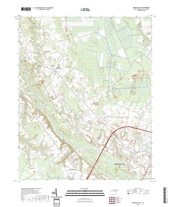
2022 Map of Greenville NW
USGS Topo · Published 2022About this map
The Tar River winds through this coastal plain landscape northwest of Greenville, defining a terrain marked by extensive wetlands and historic crossroads settlements. This 2022 survey captures the transitional zone between the expanding urban reach of the city and the rural heritage of Pitt County. To the north, the Great Swamp and Grindle Pocosin dominate the drainage basin of Conetoe Creek, while smaller communities like Belvoir, Bells Crossroads, and Hollands maintain their identity along the secondary road network. The map reveals modern land use patterns, from the Pitt-Greenville Airport and suburban developments near Rock Spring to the winding watercourses of Johnsons Mill Run and Harris Mill Run. This document provides a clear record of how contemporary infrastructure, including NC 43 N, interacts with the natural floodplain features of the river valley.
Find a feature on this map
96 named features on this map. Tap any name to fly to it.
Don’t see what you’re looking for? This feature index may not catch every label — zoom into the map to look around manually.
Map Details
Editions of this 2022 Greenville NW Map
This is the sole edition of this map. No revisions or reprints were ever made.
Other maps of this area

1901 · Parmele
USGS Topo · 1:62,500

1902 · Parmele
USGS Topo · 1:62,500

1902 · Tarboro
USGS Topo · 1:62,500

1903 · Tarboro
USGS Topo · 1:62,500

1903 · Winterville
USGS Topo · 1:62,500

1904 · Falkland
USGS Topo · 1:62,500

1905 · Winterville
USGS Topo · 1:62,500

1953 · Rocky Mount
USGS Topo · 1:250,000

1954 · Rocky Mount
USGS Topo · 1:250,000

1980 · Falkland
USGS Topo · 1:24,000