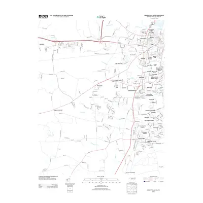
2013 Map of Greenville SW
USGS Topo · Published 2013About this map
Winterville and the southwest outskirts of Greenville anchor this landscape in 2013, illustrating the continued growth of Pitt County residential neighborhoods. The map reveals a transition from the structured street grids of established developments like Lynndale and Rollingwood to the more dispersed agricultural tracts of Tucker Farms and Green Farm. Water shapes the terrain significantly, with the Tar River in the north and the expansive Gum Swamp and Horsepen Swamp to the south influencing the layout of local roads.
Find a feature on this map
322 named features on this map. Tap any name to fly to it.
Don’t see what you’re looking for? This feature index may not catch every label — zoom into the map to look around manually.
Map Details
Editions of this 2013 Greenville SW Map
This is the sole edition of this map. No revisions or reprints were ever made.
Other maps of this area

1902 · Ayden
USGS Topo · 1:62,500

1903 · Winterville
USGS Topo · 1:62,500

1904 · Ayden
USGS Topo · 1:62,500

1904 · Falkland
USGS Topo · 1:62,500

1905 · Winterville
USGS Topo · 1:62,500

1914 · Kinston
USGS Topo · 1:48,000

1916 · Kinston
USGS Topo · 1:62,500

1953 · Rocky Mount
USGS Topo · 1:250,000

1954 · Rocky Mount
USGS Topo · 1:250,000

1980 · Falkland
USGS Topo · 1:24,000