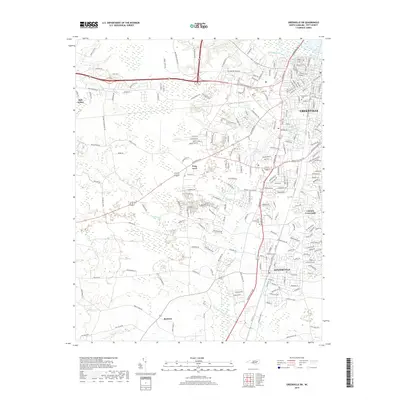
2019 Map of Greenville SW
USGS Topo · Published 2019About this map
Winterville and the southwest outskirts of Greenville anchor this 2019 survey, revealing the modern footprint of Pitt County’s expanding suburban and educational infrastructure. The landscape is defined by the transition from the Tar River corridor in the northeast to the low-lying reaches of Gum Swamp and Horsepen Swamp in the south. The campus of Pitt Community Coll serves as a central landmark, situated near the intersection of several major transit corridors that connect the outlying settlements of Frog Level and Bell Arthur.
Find a feature on this map
210 named features on this map. Tap any name to fly to it.
Don’t see what you’re looking for? This feature index may not catch every label — zoom into the map to look around manually.
Map Details
Editions of this 2019 Greenville SW Map
This is the sole edition of this map. No revisions or reprints were ever made.
Other maps of this area

1902 · Ayden
USGS Topo · 1:62,500

1903 · Winterville
USGS Topo · 1:62,500

1904 · Ayden
USGS Topo · 1:62,500

1904 · Falkland
USGS Topo · 1:62,500

1905 · Winterville
USGS Topo · 1:62,500

1914 · Kinston
USGS Topo · 1:48,000

1916 · Kinston
USGS Topo · 1:62,500

1953 · Rocky Mount
USGS Topo · 1:250,000

1954 · Rocky Mount
USGS Topo · 1:250,000

1980 · Falkland
USGS Topo · 1:24,000