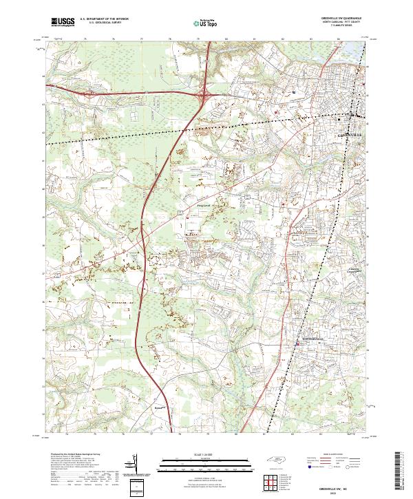
2022 Map of Greenville SW
USGS Topo · Published 2022About this map
The Tar River flows along the northern edge of this North Carolina landscape, where the expanding urban reach of Greenville meets the more rural stretches of western Pitt County. As of 2022, the transition between suburban development and agricultural heritage is clear, with neighborhoods pressing against long-standing drainage features like Greens Mill Run and Harris Mill Run. The map highlights the proximity of Pitt Community College to the growing residential corridors of Winterville, illustrating the region's educational and population shifts.
Find a feature on this map
217 named features on this map. Tap any name to fly to it.
Don’t see what you’re looking for? This feature index may not catch every label — zoom into the map to look around manually.
Map Details
Editions of this 2022 Greenville SW Map
This is the sole edition of this map. No revisions or reprints were ever made.
Other maps of this area

1902 · Ayden
USGS Topo · 1:62,500

1903 · Winterville
USGS Topo · 1:62,500

1904 · Ayden
USGS Topo · 1:62,500

1904 · Falkland
USGS Topo · 1:62,500

1905 · Winterville
USGS Topo · 1:62,500

1914 · Kinston
USGS Topo · 1:48,000

1916 · Kinston
USGS Topo · 1:62,500

1953 · Rocky Mount
USGS Topo · 1:250,000

1954 · Rocky Mount
USGS Topo · 1:250,000

1980 · Falkland
USGS Topo · 1:24,000