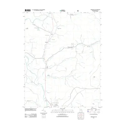
2011 Map of Greenville
USGS Topo · Published 2011About this map
Greenville sits along the southern banks of the Saint Francis River in Wayne County, serving as a focal point for this rural Missouri landscape. The river winds through the western half of the territory, joined by a dense network of tributaries including Hubble Creek, Frazier Creek, and Bounds Creek. North of the main settlement, the area is punctuated by small residential clusters such as Silva and Missionary Acres, while recreational and family history sites are scattered throughout. Genealogists will find numerous burial grounds preserved here, from Rockwell Cemetery in the southwest to White Hollow Cemetery in the east. The presence of Hunters Tourist Camp and Camp Lewallen near Lake Potashnik indicates the area's role in local outdoor recreation. Transportation is defined by a grid of county roads, such as Co RD 317, that connect these isolated homesites and valleys like Roach Hollow to the larger river corridor.
Find a feature on this map
53 named features on this map. Tap any name to fly to it.
Don’t see what you’re looking for? This feature index may not catch every label — zoom into the map to look around manually.
Map Details
Editions of this 2011 Greenville Map
This is the sole edition of this map. No revisions or reprints were ever made.
Other maps of this area

1926 · Des Arc
USGS Topo · 1:62,500

1929 · Des Arc
USGS Topo · 1:62,500

1930 · Coldwater
USGS Topo · 1:62,500

1932 · Piedmont
USGS Topo · 1:62,500

1934 · Greenville
USGS Topo · 1:62,500

1935 · Piedmont
USGS Topo · 1:62,500

1939 · Greenville
USGS Topo · 1:62,500

1949 · Rolla
USGS Topo · 1:250,000

1949 · Coldwater
USGS Topo · 1:62,500

1953 · Rolla
USGS Topo · 1:250,000