
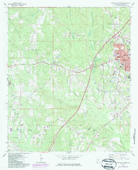
1971 Map of Greenville West
USGS Topo · Published 1973About this map
The western outskirts of Greenville and the rural reaches of Butler County are captured here in the early 1970s, showcasing a landscape transitioning from traditional agrarian patterns to modern infrastructure. The Louisville and Nashville railroad corridor anchors the eastern edge of the map, running parallel to the burgeoning residential streets of the city like Country Club Drive and Gamble St. This area is particularly dense with historic congregational markers, including Magnolia Cemetery and numerous rural sanctuaries such as Giddens Ch, Pleasant Hill Ch, and Pine Level Ch.
Find a feature on this map
46 named features on this map. Tap any name to fly to it.
Don’t see what you’re looking for? This feature index may not catch every label — zoom into the map to look around manually.
Map Details
Editions of this 1971 Greenville West Map
2 editions found
Other maps of this area

1953 · Andalusia
USGS Topo · 1:250,000

1957 · Andalusia
USGS Topo · 1:250,000

1971 · Pigeon Creek
USGS Topo · 1:24,000

1971 · Fort Deposit
USGS Topo · 1:24,000

1971 · Fort Dale
USGS Topo · 1:24,000

1971 · Greenville East
USGS Topo · 1:24,000

1971 · Georgiana East
USGS Topo · 1:24,000

1971 · Georgiana West
USGS Topo · 1:24,000

1981 · Forest Home
USGS Topo · 1:24,000
1981 · Ridgeville
USGS Topo · 1:24,000