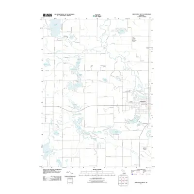
2011 Map of Greenville West
USGS Topo · Published 2011About this map
The western edges of Greenville and its surrounding glacial lake country are defined by the meandering course of the Flat River. This 2011 survey captures a landscape where agriculture and small-town expansion meet a dense network of water bodies, including Baldwin Lake, Lincoln Lake, and the expansive Wabasis Lake to the southwest. The presence of specialized sites like the Montcalm County 4H Fairgrounds and the Greenville Municipal Airport reflects the community's role as a regional hub.
Find a feature on this map
84 named features on this map. Tap any name to fly to it.
Don’t see what you’re looking for? This feature index may not catch every label — zoom into the map to look around manually.
Map Details
Editions of this 2011 Greenville West Map
This is the sole edition of this map. No revisions or reprints were ever made.
Other maps of this area

1954 · Midland
USGS Topo · 1:250,000

1958 · Midland
USGS Topo · 1:250,000

1959 · Midland
USGS Topo · 1:250,000

1959 · Howard City
USGS Topo · 1:62,500

1964 · Langston
USGS Topo · 1:24,000

1966 · Midland
USGS Topo · 1:250,000

1972 · Greenville West
USGS Topo · 1:24,000
1972 · Belding
USGS Topo · 1:24,000
1972 · Greenville East
USGS Topo · 1:24,000
1972 · Evans
USGS Topo · 1:24,000