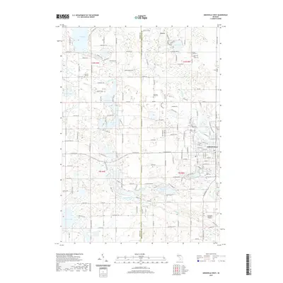
2019 Map of Greenville West
USGS Topo · Published 2019About this map
The Flat River winds through the eastern portion of this landscape, anchoring the city of Greenville and the smaller community of Gowen. This area of Montcalm and Kent counties is defined by an intricate network of glacial lakes and wetlands, including Wabasis Lake, Woodbeck Lake, and the uniquely named Little Ziegenfuss Lake. The map reveals a transition from the structured street grid of Greenville to a more dispersed rural pattern marked by numerous family and community landmarks. Genealogists and local researchers will find several burial sites preserved across the township lines, such as Spencer Mills Cem, Wolverton Plains Cem, and Forest Home Cem. Transportation infrastructure is highlighted by the Greenville Municipal Airport and a dense web of county roads that navigate the complex hydrography of the Wabasis Creek watershed.
Find a feature on this map
90 named features on this map. Tap any name to fly to it.
Don’t see what you’re looking for? This feature index may not catch every label — zoom into the map to look around manually.
Map Details
Editions of this 2019 Greenville West Map
This is the sole edition of this map. No revisions or reprints were ever made.
Other maps of this area

1954 · Midland
USGS Topo · 1:250,000

1958 · Midland
USGS Topo · 1:250,000

1959 · Midland
USGS Topo · 1:250,000

1959 · Howard City
USGS Topo · 1:62,500

1964 · Langston
USGS Topo · 1:24,000

1966 · Midland
USGS Topo · 1:250,000

1972 · Greenville West
USGS Topo · 1:24,000
1972 · Belding
USGS Topo · 1:24,000
1972 · Greenville East
USGS Topo · 1:24,000
1972 · Evans
USGS Topo · 1:24,000