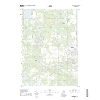
2023 Map of Greenville West
USGS Topo · Published 2023About this map
Greenville serves as the primary urban center in this West Michigan landscape, where the Flat River winds through a terrain defined by glacial lakes and established township cemeteries. The map reveals a dense network of local burial grounds, including the Saint Charles Catholic Cem and Wolverton Plains Cem, which provide significant points of interest for genealogical research in this part of Kent and Montcalm counties.
Find a feature on this map
160 named features on this map. Tap any name to fly to it.
Don’t see what you’re looking for? This feature index may not catch every label — zoom into the map to look around manually.
Map Details
Editions of this 2023 Greenville West Map
This is the sole edition of this map. No revisions or reprints were ever made.
Other maps of this area

1954 · Midland
USGS Topo · 1:250,000

1958 · Midland
USGS Topo · 1:250,000

1959 · Midland
USGS Topo · 1:250,000

1959 · Howard City
USGS Topo · 1:62,500

1964 · Langston
USGS Topo · 1:24,000

1966 · Midland
USGS Topo · 1:250,000

1972 · Greenville West
USGS Topo · 1:24,000
1972 · Belding
USGS Topo · 1:24,000
1972 · Greenville East
USGS Topo · 1:24,000
1972 · Evans
USGS Topo · 1:24,000