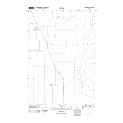
2010 Map of Greenwald
USGS Topo · Published 2010About this map
The Sauk River meanders through this portion of Stearns County, defining a landscape of agricultural drainage and small rural centers. The village of Greenwald serves as a focal point in the northwest, featuring the Greenwald Post Office and Saint Andrews Cemetery along County Hwy-13. To the south, the settlement of Spring Hill is situated near Saint Michael Cemetery, illustrating the importance of local parishes in the social geography of the area. The terrain is crisscrossed by a dense network of sectional roads and water management features like County Ditch Number Fortyfour and Stony Creek, which feed into the primary river system. This 2010 survey reflects the enduring layout of Minnesota's farming country, where family legacy and land use are etched into the grid of roads such as Oakshire Rd and Lake Henry Ave S.
Find a feature on this map
43 named features on this map. Tap any name to fly to it.
Don’t see what you’re looking for? This feature index may not catch every label — zoom into the map to look around manually.
Map Details
Editions of this 2010 Greenwald Map
This is the sole edition of this map. No revisions or reprints were ever made.
Other maps of this area

1953 · Saint Cloud
USGS Topo · 1:250,000

1957 · Saint Cloud
USGS Topo · 1:250,000

1958 · Saint Cloud
USGS Topo · 1:250,000

1965 · Greenwald
USGS Topo · 1:24,000

1965 · Sauk Centre
USGS Topo · 1:24,000

1965 · Melrose
USGS Topo · 1:24,000

1965 · Freeport
USGS Topo · 1:24,000

1965 · Elrosa
USGS Topo · 1:24,000

1965 · St Martin
USGS Topo · 1:24,000

1967 · Paynesville
USGS Topo · 1:24,000