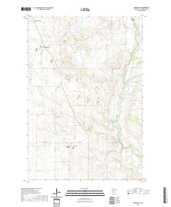
2022 Map of Greenwald
USGS Topo · Published 2022About this map
Greenwald and Meire Grove anchor this agricultural landscape in Stearns County, where the pattern of early 21st-century settlement remains tied to the township and range system. The terrain is defined by a dense network of drainage systems, including County Ditch Number Fortyfour and County Ditch Number Thirtyone, which support the intensive farming characteristic of this region. Local history is centered around community institutions like Saint Andrews Cem and Saint Michael Cem near Spring Hill, marking the enduring presence of these rural parishes. The natural hydrology is represented by Stony Cr and the winding course of the Sauk River Trl, which flows toward the northeastern corner of the map near New Munich. This survey illustrates the intersection of modern county road infrastructure with a land still heavily shaped by its watercourses and small-town centers.
Find a feature on this map
54 named features on this map. Tap any name to fly to it.
Don’t see what you’re looking for? This feature index may not catch every label — zoom into the map to look around manually.
Map Details
Editions of this 2022 Greenwald Map
This is the sole edition of this map. No revisions or reprints were ever made.
Other maps of this area

1953 · Saint Cloud
USGS Topo · 1:250,000

1957 · Saint Cloud
USGS Topo · 1:250,000

1958 · Saint Cloud
USGS Topo · 1:250,000

1965 · Greenwald
USGS Topo · 1:24,000

1965 · Sauk Centre
USGS Topo · 1:24,000

1965 · Melrose
USGS Topo · 1:24,000

1965 · Freeport
USGS Topo · 1:24,000

1965 · Elrosa
USGS Topo · 1:24,000

1965 · St Martin
USGS Topo · 1:24,000

1967 · Paynesville
USGS Topo · 1:24,000