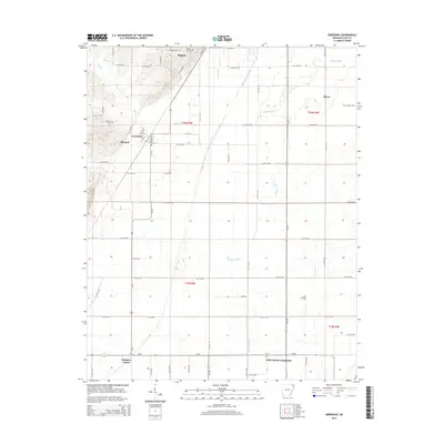
2014 Map of Greenway
USGS Topo · Published 2014About this map
The town of Piggott and the nearby community of Greenway anchor this Arkansas landscape, where the flatlands are defined by an intricate network of drainage and local roads. The terrain is notably water-marked by the wandering path of Middle Slough, which weaves through the eastern and southern sections of the map, alongside Quick Cr and Sugar Cr. These watercourses dictate the early development patterns of the region, visible in the cluster of settlements including Mitchell, Rhyne, and Hargrave Corner.
Find a feature on this map
64 named features on this map. Tap any name to fly to it.
Don’t see what you’re looking for? This feature index may not catch every label — zoom into the map to look around manually.
Map Details
Editions of this 2014 Greenway Map
This is the sole edition of this map. No revisions or reprints were ever made.
Other maps of this area

1934 · Kennett
USGS Topo · 1:62,500

1935 · Rector
USGS Topo · 1:62,500

1940 · Marmaduke
USGS Topo · 1:62,500

1940 · Kennett
USGS Topo · 1:62,500

1940 · Piggott
USGS Topo · 1:62,500

1956 · Kennett
USGS Topo · 1:62,500

1956 · Piggott
USGS Topo · 1:62,500

1957 · Poplar Bluff
USGS Topo · 1:250,000

1958 · Marmaduke
USGS Topo · 1:62,500

1958 · Rector
USGS Topo · 1:62,500