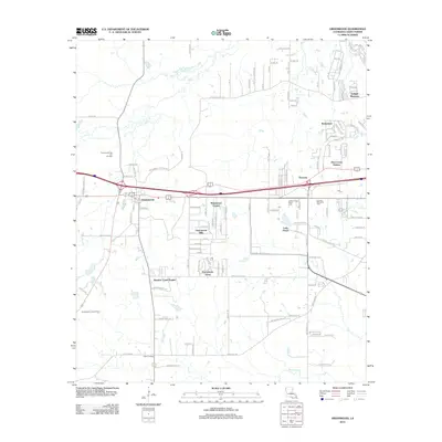
2012 Map of Greenwood
USGS Topo · Published 2012About this map
The town of Greenwood serves as a primary hub in this Caddo Parish landscape, situated just west of Shreveport. This 2012 survey illustrates the suburban expansion of the region, where numerous residential developments such as Twilight Meadows, Timberlane, and Deer Creek Estates have established a grid-like footprint across the northwestern terrain. This residential growth is contrasted by institutional and industrial sites, including the Caddo Parish Penal Farm and the Greenwood Gas and Oil Field to the west.
Find a feature on this map
121 named features on this map. Tap any name to fly to it.
Don’t see what you’re looking for? This feature index may not catch every label — zoom into the map to look around manually.
Map Details
Editions of this 2012 Greenwood Map
This is the sole edition of this map. No revisions or reprints were ever made.
Other maps of this area

1932 · Shreveport SE
USGS Topo · 1:31,680

1943 · Waskom
USGS Topo · 1:62,500

1944 · Caddo Lake
USGS Topo · 1:62,500

1945 · Waskom
USGS Topo · 1:62,500

1945 · Greenwood
USGS Topo · 1:62,500

1946 · Caddo Lake
USGS Topo · 1:62,500

1948 · Mooringsport
USGS Topo · 1:62,500

1955 · Shreveport
USGS Topo · 1:250,000
1955 · North Shreveport
USGS Topo · 1:24,000
1955 · Shreveport West
USGS Topo · 1:24,000