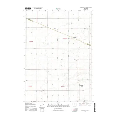
2015 Map of Greenwood Colony
USGS Topo · Published 2015About this map
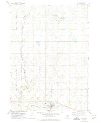
Greenwood Colony and Clearfield Colony anchor this agricultural section of South Dakota, where the geometric precision of the Public Land Survey System defines the landscape. The boundary between Douglas County and Charles Mix County cuts diagonally across the northern townships, intersecting a grid of section-line roads like 287th St and 400th Ave. Community centers and heritage are marked by the presence of Saint Paul Cem and New Salem Cem, providing essential points of reference for genealogists tracking local families. The terrain is characterized by subtle drainage patterns and small depressions typical of the Missouri Plateau, with Cr-14 serving as a primary east-west corridor through the lower half of the quadrangle.
Find a feature on this map
26 named features on this map. Tap any name to fly to it.
Don’t see what you’re looking for? This feature index may not catch every label — zoom into the map to look around manually.
Map Details
Editions of this 2015 Greenwood Colony Map
This is the sole edition of this map. No revisions or reprints were ever made.
Other maps of this area

1955 · Mitchell
USGS Topo · 1:250,000

1959 · Mitchell
USGS Topo · 1:250,000

1964 · Wagner NE
USGS Topo · 1:24,000

1964 · Wagner
USGS Topo · 1:24,000
1972 · Dante
USGS Topo · 1:24,000

1977 · Oak Hollow
USGS Topo · 1:24,000
1977 · Wagner
USGS Topo · 1:24,000
1977 · Wagner NE
USGS Topo · 1:24,000

1978 · Oak Hollow
USGS Topo · 1:24,000
1978 · Avon
USGS Topo · 1:24,000
Featured Places
- Choteau Creek Township, SD
- East Choteau Township, SD
- Clearfield Hutterite Colony, SD
- Independence Township, SD
- Kennedy Township, SD