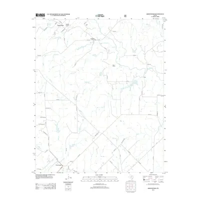
2013 Map of Greenwood
USGS Topo · Published 2013About this map
Rosston and Greenwood anchor a rural landscape defined by an intricate network of creeks and prairie crossings in Cooke County. This 2013 survey documents a region where agricultural life is mapped alongside modern aviation at the Tightwaad Air Ranch Airport near Prairie Point. The terrain is deeply etched by watercourses such as Clear Cr, Fannin Cr, and Cove Hollow Cr, which dictate the placement of county roads and historic settlements. Genealogists will find the locations of Bewley Cem and Moss Cem particularly useful for tracing local family roots. Small communities like Leo and Cove Hollow remain connected by a mix of farm-to-market roads and numbered county routes, reflecting the persistent rural character of the North Texas plains at the start of the 21st century.
Find a feature on this map
71 named features on this map. Tap any name to fly to it.
Don’t see what you’re looking for? This feature index may not catch every label — zoom into the map to look around manually.
Map Details
Editions of this 2013 Greenwood Map
This is the sole edition of this map. No revisions or reprints were ever made.
Other maps of this area

1902 · Gainesville
USGS Topo · 1:125,000

1905 · Montague
USGS Topo · 1:125,000

1943 · Gainesville
USGS Topo · 1:125,000

1954 · Sherman
USGS Topo · 1:250,000

1958 · Sherman
USGS Topo · 1:250,000

1961 · Pecan Creek
USGS Topo · 1:24,000

1961 · Freemound
USGS Topo · 1:24,000

1961 · New Harp
USGS Topo · 1:24,000

1961 · Era
USGS Topo · 1:24,000

1961 · Slidell
USGS Topo · 1:24,000