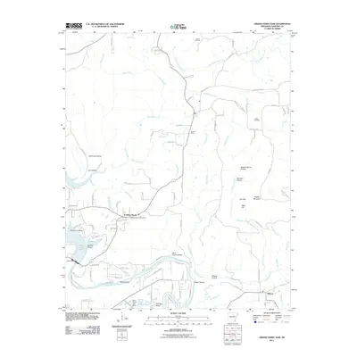
2011 Map of Greers Ferry Dam
USGS Topo · Published 2011About this map
Greers Ferry Dam stands as the central engineering feature of this Cleburne County landscape, regulating the waters of Greers Ferry Lake and the Little Red River. The surrounding terrain is defined by a series of hollows and ridges, including Simmons Hollow, Rock House Hollow, and the prominent Rigdon Mountain. Small settlements and rural hubs such as Ida, Tumbling Shoals, and Wilburn serve as the primary population centers, each maintaining its own distinct identity through local institutions like the Ida Post Office and Tumbling Shoals Post Office. Genealogists and local historians can find significant landmarks in the Antioch Cemetery and Miller Cemetery, which are situated among the winding creek networks of Canoe Creek and Wilburn Creek. The presence of features like Betty Brown Lake and Ritchie Shoals further highlights the area's complex water-driven geography.
Find a feature on this map
106 named features on this map. Tap any name to fly to it.
Don’t see what you’re looking for? This feature index may not catch every label — zoom into the map to look around manually.
Map Details
Editions of this 2011 Greers Ferry Dam Map
This is the sole edition of this map. No revisions or reprints were ever made.
Other maps of this area

1890 · Batesville
USGS Topo · 1:125,000

1891 · Batesville
USGS Topo · 1:125,000

1892 · Mountain View
USGS Topo · 1:125,000

1894 · Mountain View
USGS Topo · 1:125,000

1942 · Almond
USGS Topo · 1:31,680

1953 · Memphis
USGS Topo · 1:250,000

1956 · Memphis
USGS Topo · 1:250,000

1956 · Russellville
USGS Topo · 1:250,000

1962 · Pangburn
USGS Topo · 1:24,000

1963 · West Pangburn
USGS Topo · 1:24,000