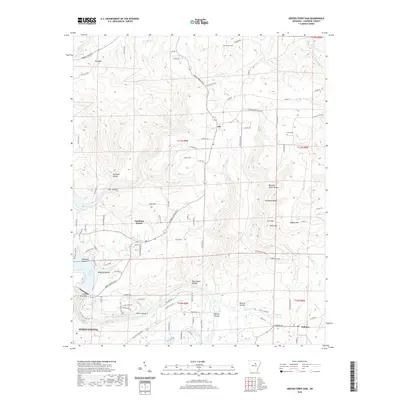
2020 Map of Greers Ferry Dam
USGS Topo · Published 2020About this map
Heber Springs and the surrounding Cleburne County landscape are defined by the convergence of the Little Red River and the eastern reaches of Greers Ferry Lake. This modern survey documents the area's transition from the water's edge into the rising topography of the Ozark foothills, featuring prominent elevations like Rigdon Mtn and Tater Hill. Local history is preserved in the location of the Antioch Cem and Miller Cem, while the river downstream of the dam reveals named navigational and fishing landmarks such as Cow Shoals and Ritchie Shoals. Smaller settlements like Ida, Tumbling Shoals, and Wilburn serve as anchor points for a network of county roads including Litaker Ridge Rd and Richwood Mountain Rd, illustrating the modern rural development patterns of the region.
Find a feature on this map
109 named features on this map. Tap any name to fly to it.
Don’t see what you’re looking for? This feature index may not catch every label — zoom into the map to look around manually.
Map Details
Editions of this 2020 Greers Ferry Dam Map
This is the sole edition of this map. No revisions or reprints were ever made.
Other maps of this area

1890 · Batesville
USGS Topo · 1:125,000

1891 · Batesville
USGS Topo · 1:125,000

1892 · Mountain View
USGS Topo · 1:125,000

1894 · Mountain View
USGS Topo · 1:125,000

1942 · Almond
USGS Topo · 1:31,680

1953 · Memphis
USGS Topo · 1:250,000

1956 · Memphis
USGS Topo · 1:250,000

1956 · Russellville
USGS Topo · 1:250,000

1962 · Pangburn
USGS Topo · 1:24,000

1963 · West Pangburn
USGS Topo · 1:24,000