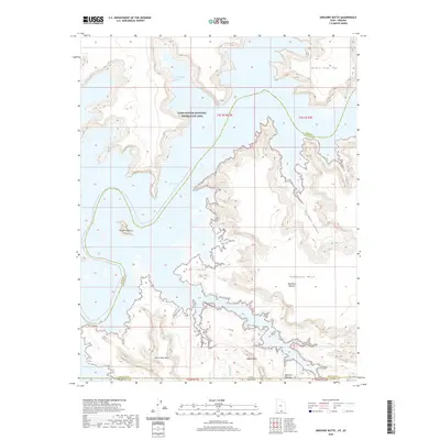
2020 Map of Gregory Butte
USGS Topo · Published 2020About this map
Lake Powell dominates the central landscape of this modern survey, where the waters of the Colorado River system meet the stark geology of northern Arizona and southern Utah. The map details the intricate shoreline of the Glen Canyon National Recreation Area, highlighting significant water-filled inlets like West Canyon and Friendship Cove. The terrain is characterized by high mesa tops and deep incisions, including the massive Cummings Mesa and the distinctive Gregory Butte. Local cultural and geographical markers such as Adeiyi Taah Hooti and Adah Hillini appear near the southern boundary, providing specific place-name data for researchers of the region's indigenous and modern nomenclature. The survey carefully tracks the complex borders where Coconino, San Juan, and Kane counties converge near the state line.
Find a feature on this map
21 named features on this map. Tap any name to fly to it.
Don’t see what you’re looking for? This feature index may not catch every label — zoom into the map to look around manually.
Map Details
Editions of this 2020 Gregory Butte Map
This is the sole edition of this map. No revisions or reprints were ever made.
Other maps of this area

1886 · Escalante
USGS Topo · 1:250,000

1886 · Echo Cliffs
USGS Topo · 1:250,000

1891 · Echo Cliffs
USGS Topo · 1:250,000

1922 · Warm Creek
USGS Topo · 1:63,360

1953 · Cummings Mesa
USGS Topo · 1:62,500

1953 · Gunsight Butte
USGS Topo · 1:62,500

1954 · Leche-E Rock
USGS Topo · 1:62,500

1954 · Navajo Creek
USGS Topo · 1:62,500

1956 · Escalante
USGS Topo · 1:250,000

1956 · Marble Canyon
USGS Topo · 1:250,000