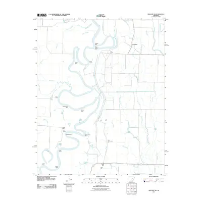
2011 Map of Gregory SW
USGS Topo · Published 2011About this map
The White River winds through a dense network of sloughs and oxbow lakes in this Arkansas river valley landscape. The river's path is marked by distinctive geological features like Peach Orchard Bluff, Smokehouse Bluff, and White Bluff, while numerous bends including Orlando Bend and Pecan Bend indicate the waterway's historical shifts. Human presence is concentrated near the settlements of McClelland and Sand Hill, with the map also preserving the location of Kings Cemetery and several river landings such as Lundies Landing and Pankey Landing.
Find a feature on this map
58 named features on this map. Tap any name to fly to it.
Don’t see what you’re looking for? This feature index may not catch every label — zoom into the map to look around manually.
Map Details
Editions of this 2011 Gregory SW Map
This is the sole edition of this map. No revisions or reprints were ever made.
Other maps of this area

1932 · Kensett
USGS Topo · 1:62,500

1935 · Kensett
USGS Topo · 1:62,500

1935 · Hazen
USGS Topo · 1:62,500

1935 · Gregory
USGS Topo · 1:62,500

1941 · Hazen
USGS Topo · 1:62,500

1941 · De Valls Bluff
USGS Topo · 1:62,500

1948 · Helena
USGS Topo · 1:250,000

1950 · Helena
USGS Topo · 1:250,000

1953 · Memphis
USGS Topo · 1:250,000

1955 · Helena
USGS Topo · 1:250,000