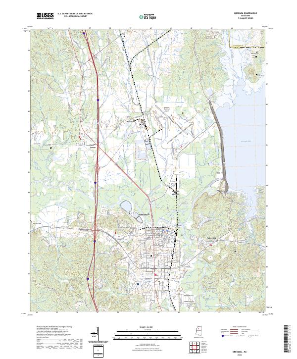
2024 Map of Grenada
USGS Topo · Published 2024About this map
Grenada sits at the convergence of the Yalobusha River and Batupan Bogue, serving as a regional center defined by its deep burial history and aviation infrastructure. The landscape is dotted with ancestral sites, including the Confederate Cemetery and numerous family or community plots like Jones Chapel Cemetery, Hebron Cemetery, and Barksdale Cemetery. To the north, the Grenada Municipal Airport occupies a significant tract near Riverdale, while the western edge transitions into the protected wetlands of the Tallahatchie National Wildlife Refuge. The map details the local road network connecting outlying settlements such as Geeslin Corner, Memphis Junction, and Futheyville. A notable hydrological feature is the influence of Grenada Lake to the east, which shapes the drainage of Perry Creek and Riverdale Creek through the surrounding lowlands.
Find a feature on this map
146 named features on this map. Tap any name to fly to it.
Don’t see what you’re looking for? This feature index may not catch every label — zoom into the map to look around manually.
Map Details
Editions of this 2024 Grenada Map
This is the sole edition of this map. No revisions or reprints were ever made.
Other maps of this area

1953 · West Point
USGS Topo · 1:250,000

1954 · Grenada
USGS Topo · 1:62,500

1954 · Duck Hill
USGS Topo · 1:62,500

1954 · McCarley
USGS Topo · 1:62,500

1955 · Coffeeville
USGS Topo · 1:62,500

1958 · West Point
USGS Topo · 1:250,000

1963 · West Point
USGS Topo · 1:250,000
1971 · Coffeeville
USGS Topo · 1:24,000
1983 · Tie Plant
USGS Topo · 1:24,000
1983 · Jefferson
USGS Topo · 1:24,000