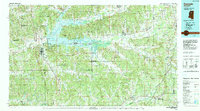
1984 Map of Grenada
USGS Topo · Published 1990About this map
The Yalobusha River and its massive impoundment, Grenada Lake, anchor the central geography of this North Central Mississippi region. Developed for flood control, the lake is surrounded by extensive conservation lands including Hugh White State Park and the Grenada State Waterfowl Management Area. To the south, the expansive Camp Mc Cain Military Reservation dominates the landscape between Grenada and Elliott, illustrating the significant military footprint in the area during the late twentieth century.
Find a feature on this map
88 named features on this map. Tap any name to fly to it.
Don’t see what you’re looking for? This feature index may not catch every label — zoom into the map to look around manually.
Map Details
Editions of this 1984 Grenada Map
This is the sole edition of this map. No revisions or reprints were ever made.
Other maps of this area

1932 · Philipp
USGS Topo · 1:48,000

1935 · Crowder
USGS Topo · 1:62,500

1935 · Philipp
USGS Topo · 1:62,500

1936 · Greenwood
USGS Topo · 1:62,500

1939 · Crowder
USGS Topo · 1:62,500

1939 · Philipp
USGS Topo · 1:62,500

1940 · Seven Pines
USGS Topo · 1:62,500

1940 · Greenwood
USGS Topo · 1:62,500

1948 · Helena
USGS Topo · 1:250,000

1950 · Helena
USGS Topo · 1:250,000