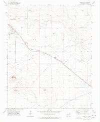
1973 Map of Grenville
USGS Topo · Published 1978About this map
The high plains of Union County are defined here by the historic path of the Santa Fe Trail (Cimarron Cutoff), which cuts diagonally across the landscape. This 1970s survey captures the small settlement of Grenville as a vital rail point along the Colorado and Southern railroad. The terrain is marked by prominent volcanic features and mesas, including the heights of Mount Clayton, Horseshoe Mountain, and the Kilburn Hills to the south. To the north, the drainage of Seneca Creek and Cherry Canyon shapes the arid geography near Sand Mesa. Local history is preserved in the location of the Cem (cemetery) north of the tracks and a Roadside Park located where the highway meets the traditional trail route, reflecting the area's long-standing role as a corridor for travelers and livestock.
Find a feature on this map
16 named features on this map. Tap any name to fly to it.
Don’t see what you’re looking for? This feature index may not catch every label — zoom into the map to look around manually.
Map Details
Editions of this 1973 Grenville Map
This is the sole edition of this map. No revisions or reprints were ever made.
Other maps of this area

1954 · Dalhart
USGS Topo · 1:250,000

1958 · Dalhart
USGS Topo · 1:250,000

1962 · Dalhart
USGS Topo · 1:250,000

1966 · Black Canyon
USGS Topo · 1:24,000

1972 · Mount Dora
USGS Topo · 1:24,000
1972 · Boiler Gap
USGS Topo · 1:24,000
1973 · Wetherly Lake
USGS Topo · 1:24,000

1973 · Grenville SW
USGS Topo · 1:24,000

1973 · Snyder Lake
USGS Topo · 1:24,000

1973 · Tripod Mountain
USGS Topo · 1:24,000