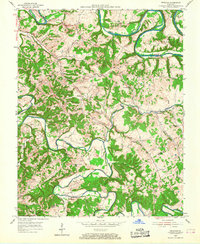
1953 Map of Gresham
USGS Topo · Published 1968About this map
The Green River carves dramatic oxbows across the northern landscape of this region, including the prominent Cox Bend, Tibbs Bend, and Lemon Bend. These sharp river meanders, paired with the winding course of Russell Creek to the south, define a rural Kentucky terrain where small agricultural settlements developed on the higher ground between the waterways. In the early 1950s, community life centered around local landmarks such as Gresham and Roachville, where country roads linked numerous family-named burial grounds and rural institutions. The map reveals a high density of local history markers, from the dual Bethlehem Old Cemetery and Bethlehem New Cemetery sites to combined facilities like Ebenezer Sch & Ch. This layout of small-scale farms, isolated schoolhouses like Howard Sch, and local churches illustrates the persistent rural social structure of the Green River valley before mid-century modernization shifted the local population centers.
Find a feature on this map
43 named features on this map. Tap any name to fly to it.
Don’t see what you’re looking for? This feature index may not catch every label — zoom into the map to look around manually.
Map Details
Editions of this 1953 Gresham Map
4 editions found
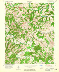

Other maps of this area

1953 · Gradyville
USGS Topo · 1:24,000

1953 · Campbellsville
USGS Topo · 1:24,000

1953 · Summersville
USGS Topo · 1:24,000

1953 · Exie
USGS Topo · 1:24,000

1953 · Gresham
USGS Topo · 1:24,000

1953 · East Fork
USGS Topo · 1:24,000

1953 · Cane Valley
USGS Topo · 1:24,000

1954 · Columbia
USGS Topo · 1:24,000

1954 · Greensburg
USGS Topo · 1:24,000

1957 · Winchester
USGS Topo · 1:250,000