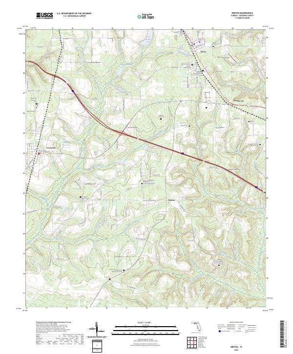
2024 Map of Gretna
USGS Topo · Published 2024About this map
Gretna and Greensboro anchor this Gadsden County landscape, where the density of rural cemeteries and churches suggests a deep-rooted social history across the Florida panhandle. The area is defined by a network of drainage basins and millponds, including Hanna Mill Pond, Byron Sube Mill Pond, and Shepards Millpond, which are fed by the meandering courses of Telogia Creek and Rocky Comfort Creek. These water bodies and their associated branches reflect the hydraulic history of the region, where small-scale milling once supported local agricultural communities.
Find a feature on this map
130 named features on this map. Tap any name to fly to it.
Don’t see what you’re looking for? This feature index may not catch every label — zoom into the map to look around manually.
Map Details
Editions of this 2024 Gretna Map
This is the sole edition of this map. No revisions or reprints were ever made.
Other maps of this area

1943 · Lake Talquin
USGS Topo · 1:62,500

1945 · Hosford
USGS Topo · 1:31,680

1954 · Tallahassee
USGS Topo · 1:250,000

1955 · Sycamore
USGS Topo · 1:24,000

1955 · Chattahoochee
USGS Topo · 1:24,000

1955 · Mt Pleasant
USGS Topo · 1:24,000

1956 · Dogtown
USGS Topo · 1:24,000

1959 · Tallahassee
USGS Topo · 1:250,000

1959 · Gretna
USGS Topo · 1:24,000

1959 · Quincy
USGS Topo · 1:24,000