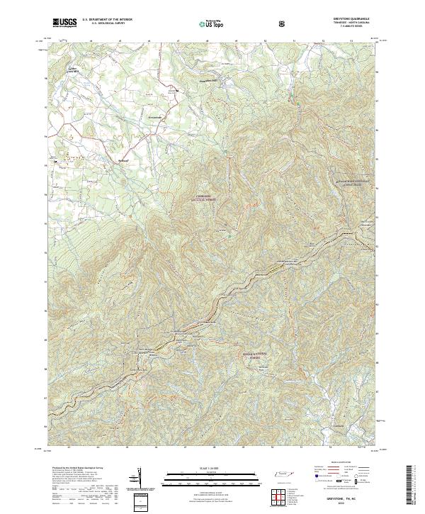
2022 Map of Greystone
USGS Topo · Published 2022About this map
Cherokee National Forest and Pisgah National Forest converge along the high ridgelines of the Bald Mountains, where the Tennessee North Carolina border follows the crest. This map details the transition from the fertile valleys of Greystone and Bethany to the dramatic heights of the Appalachian National Scenic Trail. Historically significant settlements like Water Fork Mill and Hampton Mill suggest the importance of local waterpower in the drainage basins of Water Fork and Jennings Cr.
Find a feature on this map
148 named features on this map. Tap any name to fly to it.
Don’t see what you’re looking for? This feature index may not catch every label — zoom into the map to look around manually.
Map Details
Editions of this 2022 Greystone Map
This is the sole edition of this map. No revisions or reprints were ever made.
Other maps of this area

1892 · Greeneville
USGS Topo · 1:125,000

1894 · Asheville
USGS Topo · 1:125,000

1896 · Greeneville
USGS Topo · 1:125,000

1901 · Asheville
USGS Topo · 1:125,000

1904 · Greeneville
USGS Topo · 1:125,000

1935 · Hot Springs
USGS Topo · 1:24,000

1936 · Greystone
USGS Topo · 1:24,000

1936 · Sams Gap
USGS Topo · 1:24,000
1936 · Lake Davy Crockett
USGS Topo · 1:24,000
1936 · Chuckey
USGS Topo · 1:24,000