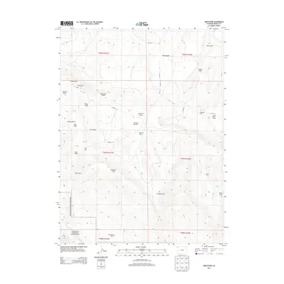
2013 Map of Greystone
USGS Topo · Published 2013About this map
Greystone sits at the northern end of this Moffat County landscape, where the high desert terrain begins its descent toward the dramatic canyons of the Green River corridor. The southern reaches of the map include a portion of Dinosaur National Monument, characterized by significant topographic relief and the distinctive Iron Mine Basin. Settlement patterns are defined by isolated ranching outposts such as Whiskey Springs Ranch and Tepee Ranch, which rely on the scarce water resources of the high plateaus, including Daisy Spring.
Find a feature on this map
37 named features on this map. Tap any name to fly to it.
Don’t see what you’re looking for? This feature index may not catch every label — zoom into the map to look around manually.
Map Details
Editions of this 2013 Greystone Map
This is the sole edition of this map. No revisions or reprints were ever made.
Other maps of this area

1907 · Rangely
USGS Topo · 1:125,000

1910 · Rangely
USGS Topo · 1:125,000

1954 · Vernal
USGS Topo · 1:250,000

1958 · Vernal
USGS Topo · 1:250,000

1960 · Vernal
USGS Topo · 1:250,000

1962 · Tanks Peak
USGS Topo · 1:24,000

1962 · Indian Water Canyon
USGS Topo · 1:24,000
1962 · Haystack Rock
USGS Topo · 1:24,000
1966 · Limestone Hill
USGS Topo · 1:24,000

1966 · Sheephead Basin
USGS Topo · 1:24,000