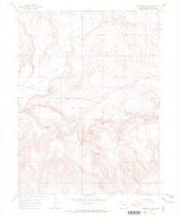
1966 Map of Limestone Hill
USGS Topo · Published 1969About this map
Douglas Mountain dominates this portion of Moffat County, rising significantly above the surrounding plateau and draws. The high-altitude terrain is marked by a series of prominent mesas and peaks, most notably John Weller Mesa and Tisdell Allred Peak, which serve as primary landmarks for navigating the complex topography. This 1966 field-checked survey highlights the scarcity of water in this arid environment, identifying vital points such as Logging Spring and the drainage network of Corral Springs Draw and Thompson Draw. The landscape's character is defined by its isolation, with only a few Jeep Trails providing access through rugged corridors like Sawmill Canyon and Happy Hollow. For the local historian, the inclusion of named features like Bill Weller Mesa and Chase Hill suggests the historical footprint of early ranching families or surveyors who first navigated these western slopes.
Find a feature on this map
17 named features on this map. Tap any name to fly to it.
Don’t see what you’re looking for? This feature index may not catch every label — zoom into the map to look around manually.
Map Details
Editions of this 1966 Limestone Hill Map
3 editions found
Other maps of this area

1907 · Rangely
USGS Topo · 1:125,000

1907 · White River
USGS Topo · 1:125,000

1910 · White River
USGS Topo · 1:125,000

1910 · Rangely
USGS Topo · 1:125,000

1954 · Vernal
USGS Topo · 1:250,000

1958 · Vernal
USGS Topo · 1:250,000

1960 · Vernal
USGS Topo · 1:250,000

1960 · Elk Springs
USGS Topo · 1:62,500

1960 · Lone Mountain
USGS Topo · 1:62,500

1962 · Indian Water Canyon
USGS Topo · 1:24,000